Distance: 14.5 miles
We were happy to welcome Peter, who would hike with us to the end of the trail in St. Bees, back into our little group. Walking through the Borrowdale valley, even in the mist, was a delight. The hamlets are no further than a mile apart and all have their own individual charm. As I left Stonethwaite the path was bordered on both sides by moss covered, rugged stone fences.

Bidding beautiful Borrowdale adieu, we walked over the wet, slippery stones through Johnny’s Wood. Fortunately, a chain was provided to aid the walker in these wet conditions. The trail took us through the village of Seatoller, known for having one of the highest rainfall averages in the UK at 137.8 inches per year. Based on our experience with rain the previous two days, I believed it!

To our great joy the sun appeared as we began an uphill march to Seatoller Fell.

Once on the fell, it appeared that our rainy, misty day was turning into a sunny one on the fells of England. Little lambs were cavorting and wildflowers were strewn along the path.

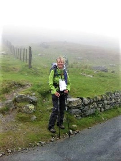
Oops! English weather happened (as it did frequently this day) and the sun disappeared as the rain and clouds descended upon us while we worked our way up to Honister Pass.
Honister Pass is well known for its slate mine which was opened around 1750 and is still active. Visitors may take a tour through it. The slate that is mined here is green in color and has been used in London on the roofs of the Ritz Hotel and St. James’s Palace. We stopped to have a cup of tea at the visitors’ center to relax and warm up. I did purchase a C2C slate coaster as a memento of the trek.

The weather had not improved as we continued on our way up the old quarry tramway towards Grey Knotts.

We carefully picked our way down, over and around the rocks on Loft Beck.

At times it was a scramble to find the right route.

Finally, the rocky path was behind us and the easy-going trail through the fell was quite welcome.

We stopped for some refreshment at the remote Black Sail Youth Hostel, which had previously been a shepherd’s bothy (a small hut or cottage) and is not accessible by car. After chatting with other hikers and eating our lunch, we were once again on our way.

The heavy cloud was (again) lifting as we descended and made our way down a gravel forest track with Ennerdale Water just peeking out through the trees in the distance. Ennerdale Water is a 2 1/2 mile-long glacial lake surrounded by high fells and is the western-most lake in the Lake District National Park.

Soon the path made its way along the River Liza, providing giving us pleasant views to enjoy as we walked by.

Approaching Ennerdale Water, we were taken in by the beauty of the Ennerdale Valley.

Looking back up the mountain, I think we just missed some heavy rainfall. Ennerdale Water was quite peaceful, though, as we walked along the water’s edge.

This day’s hike was long and exhausting, so we were thrilled to finally enter the hamlet of Ennerdale Bridge and the Shepherd’s Arms, where our B&B host, Paul Stanley, had planned to meet us.

Paul took us about two miles to Ennerdale View B&B that he and his wife, Jo, had just purchased last month. It was a lovely B&B with a terrific view of Ennerdale Water and the wild mountains of the Lake District. They prepared a superb dinner for us, after which we began an early, champagne sipping, hot-tub soaking celebration of their one-month anniversary of B&B ownership and our (near) completion of the C2C.

A snap of Paul and Jo Stanley, our very kind, hospitable hosts at Ennerdale View B&B.
