Distance: 9.1 miles
On this day, for the first time in many days, there was glorious sunshine, which meant the rain gear could stay in my pack! I was so excited about this bright day that I misread my watch and rose an hour early. I put that extra time to good use by thoroughly reading Henry Stedman’s “Coast to Coast Path”, our guidebook, for directions on our route today before Lillian, our host at Barn House served a wonderful breakfast. I bid good-bye to my new friends who were traveling in the opposite direction and was off to meet the Vermonters, Deb, Kait and Hannah, at their campsite.

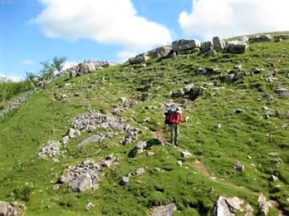
Hiking together, we first walked out of Orton, noticing that many more scarecrows were now on display for the big festival. Soon we were again on the moors and fells looking back at Orton in the distance.

Once on Crosby Ravensworth Fell, we found the path to be quite rocky.
In this area there are large stretches of what is known as limestone “pavement,” made by glacier abrasion and years of weather.

Stoppping to look back across the moors, I could see Hartley Fell (the hill of the Nine Standards) on the distant horizon.

The wide open expanses of these fells and moors are quite stunning.

Just a quarter mile from Oddendale, we noticed another prehistoric stone circle formation, the “Oddendale Stone Circles,” which had been laid down in two concentric rings.

Trail markers are usually helpful, however this one left a little to be desired (direction arrows only). It was more amusing than confusing, since our GPS was our guide.

This day the C2C Path carried us across the M6 “dual carriageway” on an overpass. “Dual carriageway” (or “dual carriage road”) is the British English for what we call a freeway or divided highway in the US. The M6 is a major traffic artery running north from London and up the western side of the island to Scotland, where it continues as A74 to Glasgow.

Occasionally, there is the absolutely clear trail sign.

Arriving in Shap, I checked into my B&B. It was not as attractive as the early information had led me to believe, but rather disappointing and dreary. I was preparing to endure this blow, when Hannah (of the Vermont girls) phoned my cell to say they had just checked into a well-kept and clean B&B, the Hermitage B&B, and would like me to join them. I gladly gave up my prepaid room and walked down the road to meet the Vermont group. As it turned out, the Hermitage was a traditional, 300 year-old home loaded with antiques and charm and Jean, the host, was very gracious and welcoming.

After settling into the B&B, we had a little time before dinner and walked around the town center. We then selected the Crown Inn Pub – a pub focused on serving the “locals, walkers and cyclists” who pass through Shap. This town is at the intersection of two trails: the east/west Coast to Coast Path and the north/south “Lands End to John O’Groats” cycle ride. This cycle ride is a 10 to 14 day trip from the southwestern tip of England (Land’s End) to the northeastern tip of Scotland (the town of John O’Groats, just below the Orkney Islands), but I digress. The pub’s food was great!
One thought