RT: 7.2 miles
In the late spring of 2020, shortly after California allowed “Phase 2” freedom from the government mandated, COVID-19 inspired, three-month SIP (Shelter in Place) restriction, I had to get out – and drove to see a hiking friend in the community of Sonora, in central California. We had previously discussed taking a couple days to do some early hikes in the hills closer to the higher ranges of the still snow-covered, Sierra Nevada mountains. The first trail we selected, to Relief Reservoir, was an “out and back” hike from Kennedy Meadows, just off highway 108 near Sonora Pass. Yes, there was irony in the name: relief from the COVID restrictions was what we desired. Much of the trail had been cut from the walls of a narrow gorge (carved by the middle fork of the Stanislaus River) and led back to the reservoir which was built in the early 20th century. As we hiked, it was not difficult to consider the many miners and their families who had “rushed” to California after gold was discovered in Sutter’s Mill in 1849, some 80 miles north of Sonora, and their digging and panning for gold in these hills. Upon reaching the reservoir, we could also ponder the struggles necessary to complete this massive dam project in these inaccessible hills. These days, this dam provides a beautiful destination for hikers who have a glorious experience of rock walls, rushing water, lush plant life and (frequently during the summer months) blue skies.
In order to avoid the heat, we left from the General Store early and, at the trailhead, enjoyed Kennedy Meadows with a spectacular mountain backdrop.

The Middle Fork of the Stanislaus River or its tributaries were our constant companions along this trail. The melting snow from the surrounding mountains provided ample water for an impressive view as we traversed the river on a bridge.

A steady climb began as we followed the route that the dam builders had made to access the remote dam site.

Looking up to the left as we ascended, Kennedy Creek came bounding down the mountain. This creek flows from Kennedy Lake much further up the canyon.

A rather impressive bridge crosses high above Summit Creek as we began to follow that tributary toward Relief Reservoir.

Gushing Summit Creek was tumbling down the gorge from the reservoir.

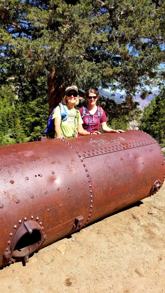
Alongside the trail were remnants of the old steam donkeys, the power winches used to pull supplies and equipment up the mountain.

And then, there it was, beautiful Relief Reservoir surrounded by masses of granite.

Looking back, the large dam came into view making a spectacular sight.

My friend, Lynda, and I couldn’t resist the photo op!

On the return trip we were glad that we had started early, as the day had become quite warm. The river looked very inviting, but we kept moving on.

Completing the hike at the General Store, we rewarded ourselves with an ice cream, always a great way to end a hike!

One thought